Mount Maxwell is known for its stunning views and is a must see during a visit to Salt Spring Island.
This 231 hectare park was originally established for its distinctive landmark viewing point in 1938.
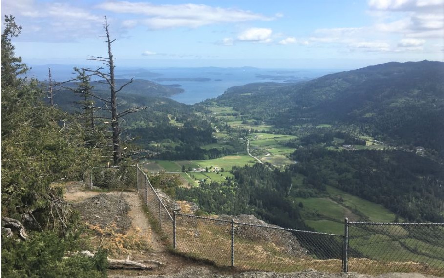
The point, called Baynes Peak, offers superb views of Vancouver Island, the surrounding Gulf Islands and the mainland of British Columbia.
The day use only park has protected stands of old-growth Douglas fir, Garry oak meadows, salmon bearing creeks and the largest undeveloped estuary in the Gulf Islands.
The park is a popular destination for tourists and residents alike, who come to picnic, hike, and enjoy the spectacular views.
Mount Maxwell Provincial Park is part of the Mount Maxwell Ecological Reserve and Burgoyne Bay Provincial Park, which combine to create over 1100 ha of protected area stretching from mountain top to shoreline and across Burgoyne Bay to the slopes of Mount Bruce.
As vehicles can drive to the top of the mountain park, walking the trails is pleasant and doable by just about anyone. Keep an eye on young children at all times due to steep drop offs.
Following the trail from the parking lot will take you around a series of amazing viewpoints and loops that go back to the access road.
There are fences along most view points, however there are all sorts of unofficial trails to explore as well as other ways to get up the mountain besides the official route.
Use extreme caution along the cliff edge – do not cross over any fences due to the steep drop.
Allow an hour or two to explore the park and take plenty of photos as there are over 6 km. of trails.
Pets must be kept on a leash at all times. The park has some wheelchair accessibility. There is also a pit toilet in the day use area.
Mount Maxwell Provincial Park is located at the end of Mt. Maxwell Road on Salt Spring Island.
Get ferry schedules and allow plenty of time. A good time to explore the island is in spring, summer or fall on a Saturday and take advantage of the Salt Spring Island Market.
Interest Points
The park provides stunning views of Burgoyne Valley, Fulford Harbour as well as the Gulf Islands and Vancouver Island.
Getting There
From Fulford ferry terminal, drive north on the Fulford/Ganges Road for 12.6 km and then turn left onto Cranberry Drive. Route to the top of Mt Maxwell is best suited to 4 wheel drive vehicles although passable by regular vehicles.
BE ADVISED: The road to the peak is steep, narrow and bumpy.
Trail Rating: Easy
There is more information on the BC Parks Site with some info on where the trails are, and some other great nature information here.
Originally established for its distinctive landmark viewing point in 1938, Mount Maxwell Provincial Park contains one of the highest points on Salt Spring Island in the Southern Gulf Islands. This point, called Baynes Peak, offers superb views of Vancouver Island, the surrounding Gulf Islands and the mainland of British Columbia.
Also found in this day-use only park and surrounding protected area are stands of old-growth Douglas fir, Garry oak meadows, salmon bearing creeks and the largest undeveloped estuary in the Gulf Islands. Mount Maxwell Provincial Park is a popular destination for residents and visitors, who come here to picnic, hike, and enjoy the spectacular views. From the top of Mount Maxwell visitors have a unique opportunity to see the topside of soaring raptors, or to peer through the mist and marvel at the panoramic views.
Mount Maxwell Provincial Park, contiguous with Mount Maxwell Ecological Reserve and Burgoyne Bay Provincial Park, combine to create over 1100 ha of protected area stretching from mountain top to shoreline and across Burgoyne Bay to the slopes of Mount Bruce.
Park Size: 231 hectares, Date Established: October 21, 1938. Mt. Maxwell